IKAS Evolution Office

IKAS Evolution

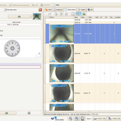
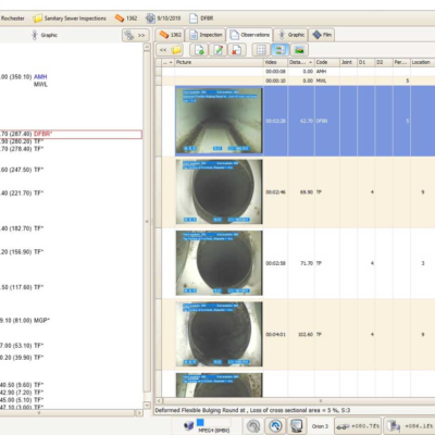
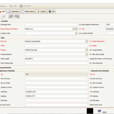
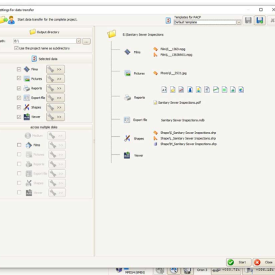
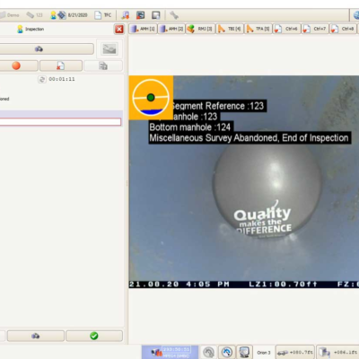
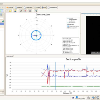
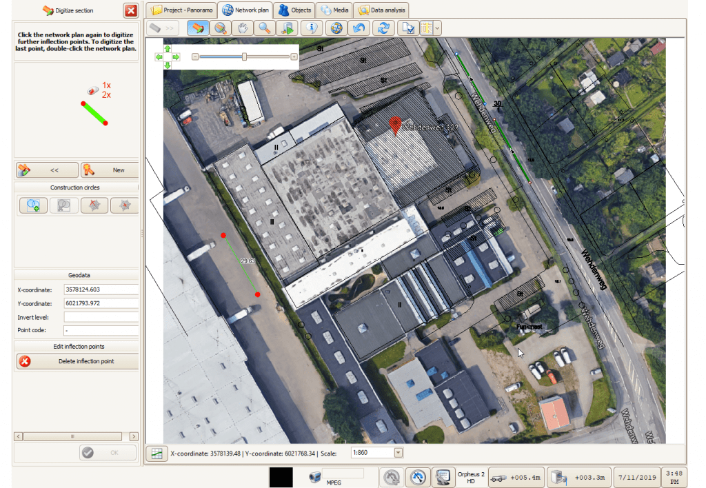
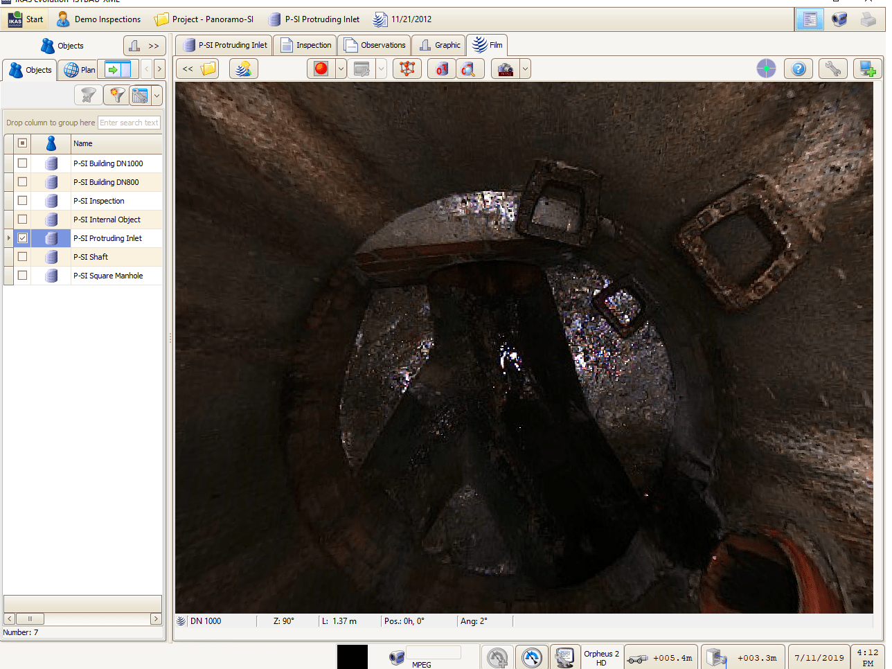
IKAS Evolution Office support application allows users to review and manage data, generate reports, and produce viewer disk for delivery. Several expansion extensions are available to allow post field inspection coding and further analysis.

Details
  • Basic sewer data projects – basic module type
  • Managed sewer objects: sections, manholes, and laterals
  • Standard-compliant sewer data acquisition
  • Operation with task-related menus and dialogues
  • Assistant for condition data acquisition
  • Management of sewer objects with master and condition data, photo and video data
  • Import and attribution of digital photos to condition data
  • Digital single image capture from linked videos
  • Data transfer assistant
  • License-free sewer MPEG player for data transfer (without an MPEG decoder)
    • Import of videos with optional attribution to the inspection data
    • Condition data acquisition synchronized with video playback
    • Digital single image capture from video playback
  • No MPEG recording

IKAS Evolution PACP, LACP, & MACP Interface Extension

Evolution Compatibility
Evolution Modules
Map Viewer
  • Graphical display of the sewer network with manholes, sections and laterals from the coordinates of the sewer data according to the data interface
  • Interactive operation with links to the sewer and inspection data
  • Work progress indicator for graphical processing of the TV inspection
  • Display of pipe runs with inflection points
  • Site plans/background maps
    • Display in raster and vector format (DXF, TIF, JPG, PNG, BMP)
    • Geo-referenced
    • Fitting in of scanned background maps with 3 possible modes:
      1. Aligning matching points;
      2. Entering known co-ordinates
      3. Setting the scale and position of background maps
    • Management of plan directories
  • Display configuration with GIS layer management
  • Per each IKAS Evolution workstation
Map Editor

Extends the Map Viewer with:

  • Graphical sewer network editing/digitizing functions
  • Digitization of sections, manholes, and laterals
    • Includes run of sections (laterals) via inflection points
  • Shifting of manholes and pipe run inflection points
  • Setting parameter texts free

**Map Viewer is required!**

Map Route Assistant

Extends the MapViewer + Editor with:

  • The lateral run assistant
    • Generation of the lateral run from the inspection data
    • Automatic calculation of bends and branch sewers/connection pipes from the measurement data and the TV inspection
    • Optional measurement with the Navigator
    • Fitting the pipe run to fixed points
  • Live display of the lateral run during the camera inspection

**Map Viewer + Editor are required!**

3D GeoSense
  • Acquisition of IBAK 3D sensor measured data for the survey of sewer pipe runs with x, y, and z coordinates
  • In one operation with the TV inspection
  • Real time presentation of the surveyed pipe run during the TV inspection
  • The pipe run is stored with the x, y, z coordinates according to the reference coordinate system
  • Export to all supported sewer data formats
  • Adaptation to geo fixed points with assistant functions of the IKAS Evolution Map Route Assistant

**For IBAK TV systems equipped with 3D sensors & IKAS Evolution Map Route Assistant required!**

Defects Measurement

  • For IBAK pan and tilt cameras on camera tractors (trigonometric method)
  • For cameras with parallel lasers on camera tractors (reference measurement)

Laser Deformation Measurement

  • For IBAK laser cameras
  • Point-wise deformation measurements
  • IBAK cameras with measurement lasers
  • For ellipsoid deformation of flexible pipes
  • Measurement with 5 measuring points

  • Branch sewer identification (angle, direction, diameter)
  • Elbow bend identification (angle, direction) in PVC pipes (Navigator I for vitrified clay)
  • Assistant for acquisition of branch sewers, bends/elbow bend angles and directions by means of graphical video image analysis
  • Extension to the Map Route Assistant
  • Directions are stored as clock face positions and additionally in degrees

*Requirements*

  • Map Route Assistant
  • Video source with undistorted aspect ratio
  • Upright camera image or IBAK camera position sensor
  • Also with video analysis or single defects image
  • Check the supported coding systems

Tilt Measurement
  • For office workstation, TV and PANORAMO system
  • For sections and laterals
  • Measured data acquisition and management also for reverse measurement
  • Invert elevation correction
  • Measuring diagrams and report function
Temperature Measurement

  • For office workstation, TV system
  • For sections and laterals
  • Measured data acquisition and management, also for reverse measurement
  • Measurement diagrams and report function

Reference Image Defects Measurement

  • Defects measurement on reference images
  • Measurement of defects on pipe walls using a digital image
  • Based on reference values in conjunction to the optical system and the diameter
  • GUI for calibration of camera systems/diameters
  • Per workstation

Job Rule Management

  • Templates for project settings such as video overlay, condition coding system, reference tables, etc.

Video Analysis

  • Import of videos with optional attribution to the inspection data
  • Condition data acquisition in synchronization with video playback
  • Digital single image capture from the video playback
  • No MPEG recording

Continuous Profile Analysis (LaserScan)
  • Sectional continuous profile analysis with IBAK Profile Laser cameras
  • Spiral laser measurement with ORPHEUS 2
  • For any forms of deformation of flexible pipes
  • Profile analysis reports completely integrated
  • For IKAS Evolution Vehicle or Office only

**Videos have to be made by the IBAK profile recording function in IKAS Evolution!**

PANORAMO Analysis Pipeline + SI

Assistant for analysis of the recorded PANORAMO scan data for sections and manholes

  • Import of PANORAMO films with optional attribution to the inspection data
  • Condition data acquisition on the basis of the recorded PANORAMO films
  • Replaces conventional EDE mode
  • Inspection data acquisition – PANORAMO analysis
  • For section and manhole PANORAMO films
  • Single image digitization
  • Defects measurement in PANORAMO films (optional 3D measurement)
  • Data transfer with freeware PANORAMO Viewer
PANORAMO Analysis SI

Assistant for analysis of the recorded PANORAMO SI scan data for sections and manholes

  • Import of PANORAMO SI films with optional attribution to the inspection data
  • Condition data acquisition on the basis of the recorded PANORAMO SI films
  • Replaces conventional EDE mode
  • Inspection data acquisition – PANORAMO SI analysis
  • For manhole PANORAMO films
  • Single image digitization
  • Defects measurement in PANORAMO films (optional 3D measurement)
  • Data transfer with freeware PANORAMO Viewer
PANORAMO SI 3D Measurement

Extension of PANORAMO Analysis SI

  • Photogrammetric measuring method
  • Measurement of distances and pipe diameters with circular and oval section
  • In manholes with any profile shape
  • The measured object must be included in the point cloud
  • The result of the measurement:
    • Is saved to the PANORAMO film
    • Graphical display in the 3D view and point cloud
    • Numerical data in condition coding system
Shape

Data exchange in the ESRI ArcGIS Shape format for object parameters regarding section, manhole, and laterals*

  • Primary keys must be available in the Shapes
  • Export:
    • Object geometry as Shape
  • User configuration of the object parameters that are to be exported (Alignment of the object data fields to the Shape file)
  • Import:
    • User configuration of the object parameters that are to be imported (Alignment of the Shape data fields to the IKAS/IKIS object fields)
    • load/save different field alignments

* Depending on the database configuration

SanPlan

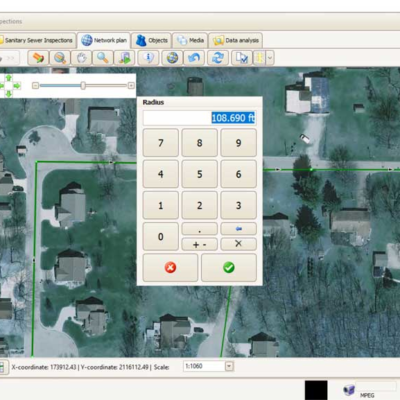
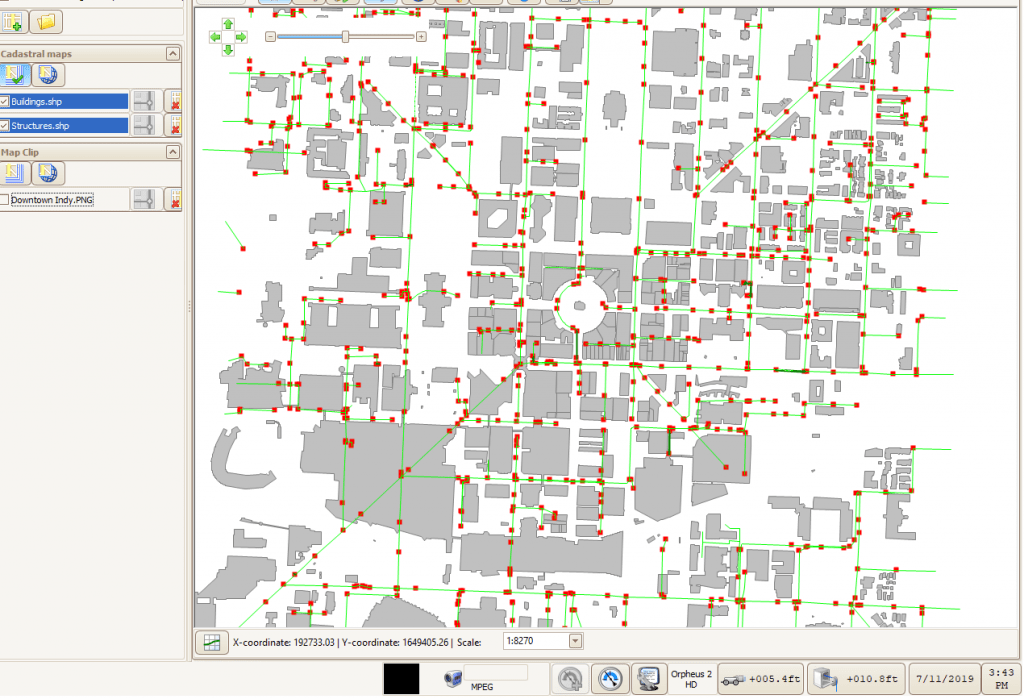
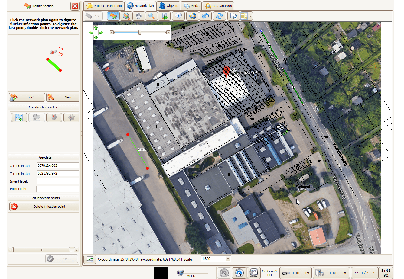
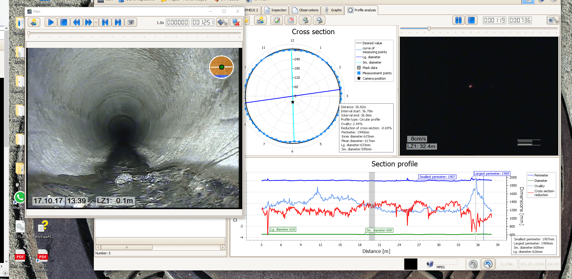
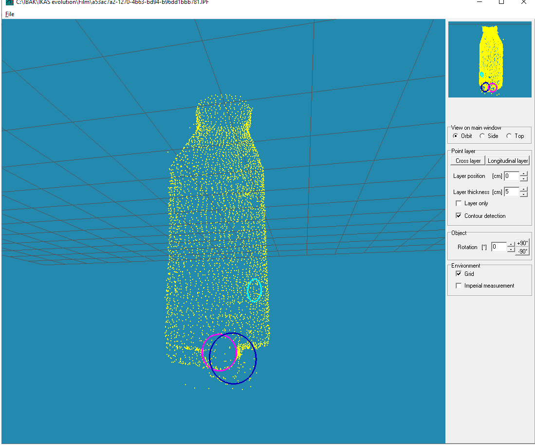
Detailed Rehabilitation Planning Tool as an extension to IKAS Evolution Office

  • Sewer data for sewer sections, laterals, and manholes
  • Import according to the IKAS Evolution interfaces
  • Client-server operation possible with project locking (only one user can access a project at a time)
  • Creation of several planning variants
  • Demand, preliminary and basic planning
  • Rehabilitation types with: repair, renovation and reconstruction planing and decommissioning
  • Any number of planning variants
  • Specification of a preferred variant
  • Hierarchical table of rehabilitation techniques (must be built by the user)
  • Technique filter controllable by object parameters and rehabilitation types
  • Rehabilitation report

Need more information?

any questions? contact us.
(800) 656-4225  |  sales@rapidview.com